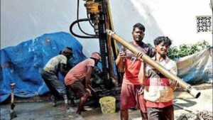
AHMEDABAD: Amdavadis are pumping so much water from the ground that parts of the city are sinking. A recent study by the Institute of Seismological Research has found a strong correlation between land subsidence (sinking) and depletion of groundwater. Areas surrounding Bopal-Ghuma in the west and the industrial Area of Vatva in the east are sinking 25 mm per year. “The water wells of Bopal, Arbudanagar, Hazipur garden and Garden and Ghuma indicate subsidence of about 2.0 mm/yr. Large ground subsidence of 9.8 mm/year is also estimated at Sola well, followed by a subsidence rate of 8.2 mm/year at Shilaj stated the study published in the Geocarto International journal, a reputed scientific journal published by Taylor & Francis.

Experts say land subsidence is a cause of concern as it lead to to micro-level topographic changes, cracks and fissures in the surface and ultimately causes heavy damage to city infrastructure like newly laid underground civic lines and even concrete structures on the surface. “The south-eastern part of the city and parts of neighbouring rural areas experienced high levels of subsidence. The west-central and east-central parts of the city reveal moderate and low subsidence, respectively,” claimed the study by ISR researchers Rakesh Dumka, Sandip Prajapati and D Suribabu. “Spontaneous water removal leads to vertical compression of aquifer sediments by reducing pore pressure and soil compaction resulting in land subsidence. Land sinking promotes micro-level topographic changes, cracks and fissures in the surface, ultimately causing heavy damage to city infrastructure,” says Dumka. “The Vatva well indicates a subsidence rate of 8.1 mm/year. Significant sinking of up to level of 3.0 mm/year is also estimated in the central part of the city,” states the study. The scientists had relied on groundwater level data from the central groundwater board between 1996 and 2020. They painstakingly used Sentinel satellite’s Interferometry Synthetic Aperture Radar data between 2017 and 2020, which measures ground deformation with an accuracy of sub-centimetre level, and the latest Global Navigation Satellite System-based precise technique to measure land subsidence. The scientists have appealed for greater public participation to arrest this phenomenon, including implementation of Groundwater recharge in town planning schemes and its insistence in municipal governance. source : https://timesofindia.indiatimes.com/city/ahmedabad/bopal-vatva-sinking-along-with-groundwater-levels-in-abad/articleshow/87766940.cms
“Save water, and it will save you”
Vardhman Envirotech, India's Passionate Rainwater Company.
